发掘地球上不为人知的奇观
BBC双语阅读默里·福莱特(Molly Flatt)(2023年12月11日)
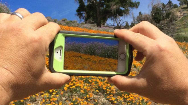
加州罂粟花.(图片来源:Geri Lavrov / Getty Images)
想象一下这个场景:你独自一人,迷了路,误入一片陌生的森林。放眼望去,没有明显可走的路,而夜色渐渐降临,你忽地发现自己身陷黑暗之中,四周是此起彼伏,阵阵作响的咕噜声、唬唬声、嗥叫声。
对我们中的大部分人来说,本能的会觉得这样的场景非常恐怖。对迷路的恐惧深深根植于人类的心灵中,我们往往觉得,未知的地方藏着未知的危险。我们最初听到的那些故事中,无论是《小红帽》(Little Red Riding Hood),还是《糖果屋》(Hansel and Gretel),无一不在向我们的心灵深处中印刻/渗透这样一条训言:迷路就意味着身陷险境,尤其是在有大自然掺合的时候。
既然如此,也就难怪导航系统会在人类最古老的社群平台上占有重要地位。著名的壁画洞穴拉斯科(Lascaux)为旧石器时代的人们提供了难能可贵的容身之所,在这里,他们避开了迫在眉睫的危险,并聚合成为一个社群。拉斯科洞穴中刻有一幅夜空图,此图有16,500年的历史。同时,人们还在西班牙的德尔卡斯蒂略洞穴(Cueva di El Castillo)中发现了一幅14,000年前绘制的星座图,图上的星座我们现在命名为北冕座(Northern Crown)。
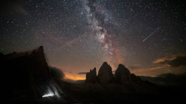
意大利多洛米蒂山脉中观看到的银河系。(图片来源:Marka / Getty Images)
慕尼黑大学(University of Munich)的德国研究人员迈克尔·拉彭鲁克博士(Dr Michael Rappenglueck)指出,这些壁画与野兽和杂交生物的图像相伴出现,描绘了“一幅史前宇宙的天体图。它是远古人类的天空,充满了动物和灵魂向导。”
几千年后,人类仍然怀揣着一如当初的热忱,渴望绘制出世界地图。十六世纪至十七世纪,荷兰商人引领了人类首个测绘地图的黄金时代。而随后到二十一世纪,第二个制图的黄金时代正在上演,技术专家成了其中的弄潮儿。诸如谷歌地图、Citymapper、TomTom及以色列新秀Moovit(今年年初,Moovit斩获了3300万英镑的巨额融资)等工具确保了即便对于那些天生路痴的人,也渐渐难以在城里走丢。同时,先进的测绘技术正踱出城市的街道,向人迹罕至的荒郊野地开拓进发。
Komoot是一款覆盖全欧的导航利器应用程序,它从诸如开放式街道地图(OpenStreetMap)和美国国家航空航天局(NASA)的数据库中提取数据,再根据徒步旅行者和骑行者各自的体能状况,为他们量身定制地形图。随后,图上的信息用一块智能手表就可以同步出来,手表还会据此提供全程语音导航。其它应用则将注意力转向实境扩增技术(AR),用它来解决广袤的野外地区的实景测绘问题。经纬仪(Theodolite)使智能手机的照相机摇身一变,成为一个可以人机对话的指南针、全球卫星定位系统、地图、测距仪、数据日志及双轴测斜仪;Peaks(山峰)软件可以辨认出山体的位置;Start Chart(星图)软件将夜空变成了一张标注了星体位置的图表;与此同时,海风(Sea Breeze)的三维仿真技术将栩栩如生的气流和天气状况添加到了导航视图上。
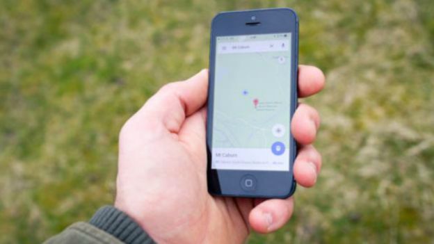
在智能手机上查看地图。(图片来源:Gerard Puigmal / Getty Images)
倘若这些工具给人们带来了跨越界限、外出探险的信心,并帮助人们更好地欣赏和理解自然界,那我们的确应该欣喜庆贺。但是,与所有技术一样,它们还有另外的一面。如果我们持续不断地使用“地理定位功能”,在精神上听从掌上数字设备的指引,始终待在有它们保护的安全地带,那么,我们是否错失了那种只有迷路才能带来的更加深入的差别化认知?
博物学家、诗人大卫·怀特(David Whyte)认为,我们只有丢掉那些先入为主的文字、图片和地图,身处自然环境、自身家园之中,才能真正地了解它们。“从进化的角度讲,我们有为各项事物命名的必要,”他在科纳马拉(Connemara)接受电话采访时解释道,他即将带领32位来自世界各地的作家从这里出发,来一段徒步之旅。“实际上,正是与之相同的念头促使我们成为杰出的科学家。但当我从海洋动物学专业毕业,前往加拉帕戈斯群岛(Galapagos Islands)时,我竟发现那里的飞禽走兽和我在各类书本上学到的都不是一回事。一旦你进入外部的自然世界,你就会发现它并不遵循你的套路。”
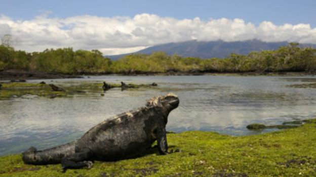
加拉帕戈斯群岛中,海鬣蜥在退潮时取食海藻。(图片来源:Wolfgang Kaehler / Getty Images)
正是一种对事物真谛的顿悟,使怀特以一名诗人而不是科学家的身份开始探索这个世界。而且如今,他认为,我们只有学会关心自然,才能逐渐在真正意义上“通晓”自然——而这正是大多数此类应用都怂恿我们外包给他们的技能。
他说:“身处加拉帕戈斯群岛,我意识到了自己的身份并不取决于信仰,不管我是信仰科学,还是信仰宗教,抑或另有其它信仰。我的身份取决于我对世界有多留心。当然,当你不知道你在哪里的时候,你会更加关注这个世界。”
换言之,正如1931年,艾尔弗雷德·科日布斯基(Alfred Korzybski)在美国科学促进会(American Association for the Advancement of Science)于新奥尔良(New Orleans)召开的会议上所说的那句名言:地图并不是实打实的疆域。那些花时间在大自然中待过人会明白,不管地图多么精细复杂,都只是一张张图片而已。屏幕上的地图无论在实时性、三维效果以及高分辨率上有多大的提升,始终与人们亲身看到的事物存在差别。
“真实的自然界中,充满了形形色色丰富多彩的情境。对人类而言,这是极大的满足,”怀特解释道。“它有深浅,有高低,有香臭,还有你脚下的土地。同一时间里,自然界中有生有死;同一时间里,自然界既漂亮又很混乱。然而,当孩子们习惯于只要点点屏幕上方框,就可以把生活归置得井井有条时,他们会因为自然界中丰富多变的情境而感到害怕。”
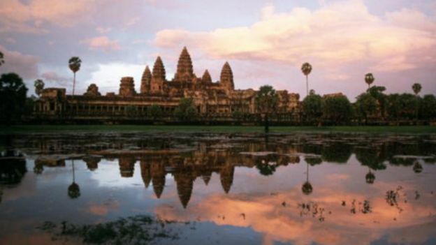
柬埔寨吴哥窟的神殿。(图片来源:Roland Neveu / Getty Images)
多亏了谷歌地图新推出的“街景服务”功能,如今,我们每个人都可以在午餐时间,观赏到诸如吴哥窟和亚马逊河等遥远自然环境保护区的360度实景影像。这实在是妙不可言。然而,如果我们想真正地体验各地景致的奇妙之处,怀特认为,我们可能最好还是不要带电子设备,就单纯地到一座城市公园中溜达溜达,抑或走一条不熟悉的路线回家。
“当你头一次涉足外部的自然世界时,它会让你深感恐惧。但一旦你不再竭力谩骂它,你可以让它以自己的声音回应你。你可以到外面走走,一直漫步到你们村庄或小镇的边缘,甚至可以沿着伦敦的运河遛弯。而如果你留心在意,你可以就在当时当地来一次美丽的迷路。”
格林童话素来反映出了人类的欲望和恐惧。现在,脸书每个月都会有2亿名用户对他们的地理位置进行标注,在这样一个时代里,与其说走丢这个念头会让人心生恐惧,不如说它会激发一种兴奋而自由的感觉。去年,奥斯卡提名电影《涉足荒野》(Wild)的大受欢迎表明了,人们意识到一成不变的选择更可怕;正如环保人士兼记者丽贝卡·索尔尼特(Rebecca Solnit)在她的散文集《野外迷路指南》(A Field Guide To Getting Lost)中所阐述的那样:“从未走丢过的人生,不算真正活过。”
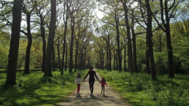
在森林里漫步的一家人。(图片来源:Prototype71 Design Pte Ltd / Getty Images)
索尔尼特像怀特一样担心,数字化和网路化会减少我们接触未知世界的机会。她解释道,“lost”一词来源于古斯堪的纳维亚语(Old Norse)中的“los”,意指军队的解散。她写道:“这一起源的言下之意是说,士兵们走出编队,回到家中,与大千世界休战。我担心现在很多人一辈子也不会解散他们的军队,永远不会超越他们所知晓的范围。而广告、危言耸听的新闻、科技、没边没际的忙碌、以及公共空间和私人空间中的设计方式合力将这样的担忧变成为现实。”
毫无疑问,导航系统无论是帮我们在周一上午找到最快的上班路线,还是在去夏天度假露营地的路上避开一段四小时弯路等方面还是非常有用的。导航技术使我们的生活更加高效,也更舒适愉悦。
但是,我们也应该抽出一些时间,偶尔迷个路,即便就只是在我们家的后院里。通过时不时地迷失自身的方位,我们会给自己带来进一步探索地球、发现自我的机会,其中的收获可比一千条数据可能传输的信息量都要大。
(责编:友义)
Discover Earth's wild wonders in a networked world
By Molly Flatt,11 December 2024
Imagine that you’ve strayed into an unfamiliar forest, all alone. There’s no obvious path, night is falling, and you suddenly find yourself in darkness, surrounded by a chorus of unidentified grunts, hoots and howls.
For most of us, such scenarios are instinctively terrifying. The fear of getting lost is deeply embedded in the human psyche, to which unknown places hide unknown threats. The earliest stories we hear, from Little Red Riding Hood to Hansel and Gretel, ingrain the message lostness means danger, especially when Mother Nature’s involved.
It is little wonder, then, that navigational systems feature in human beings’ oldest social platforms. The famous painted caves of Lascaux – spaces which provided a rare opportunity for Paleolithic man to shelter from imminent dangers and gather as a community – show a 16,500 year old map of the night sky, while the Cueva di El Castillo cave in Spain bears a 14,000 year old painting of the constellation we call the Northern Crown.
With their accompanying images of beasts and hybrid creatures, the paintings represent, according to German researcher Dr Michael Rappenglueck of the University of Munich, “a map of the prehistoric cosmos. It was their sky, full of animals and spirit guides.”
A few millennia on, our hunger to map our world remains undiminished. While the first golden age of cartography was driven by Dutch merchants in the sixteenth and seventeenth centuries, the second is being spearheaded by twenty-first century technologists. Apps such as Google Maps, Citymapper, TomTom and new Israeli contender Moovit - which secured an impressive £33 million funding early this year – have ensured that getting lost in the city is becoming impossible even for those of us with a talent for wrong turns. And sophisticated mapping technologies are roaming beyond urban streets to colonise our wild places, too.
The fear of getting lost is deeply embedded in the human psyche, to which unknown places hide unknown threats
Komoot is a Europe-wide app which pulls data from sources such as OpenStreetMap and NASA to provide hikers and bikers with topographic maps tailored to their fitness levels, which can then be synched with a smartwatch to provide turn-by-turn voice navigation. Other apps are turning to augmented reality (AR) to conquer the great outdoors. Theodolite turns your smartphone’s camera into an interactive compass, GPS, map, rangefinder, data log and two-axis inclinometer; Peaks recognises mountains; Star Chart turns the night sky into a star chart; while Sea Breeze 3D superimposes animated wind and weather conditions onto your view.
These tools are surely cause for celebration, if they give people confidence to venture out beyond their boundaries, and help them to better appreciate and understand the natural world. But there is, as with all technology, a flipside. If we remain continually ‘geolocated’, always safe in the custody of our handheld digital spirit guides, do we miss a different, deeper sort of understanding that only lostness can provide?
Once you get out into the natural world you learn that it doesn’t follow your rules
Naturalist and poet David Whyte believes that we can only really get to know our environment, and our own place within it, by dropping our preconceived words, images and maps. “We have this evolutionary necessity to name things,” he explains over the telephone from Connemara, where he is about to lead thirty-two writers from across the world on a walking tour. “It is actually the same mind that helps us to be good scientists. But when, freshly graduated with a degree in marine zoology, I went to the Galapagos Islands, I found that none of the birds and animals had read any of the books I had read. Once you get out into the natural world you learn that it doesn’t follow your rules.”
It was an epiphany that launched Whyte’s exploration of the world as a poet rather than a scientist, and he now believes that we can only truly come to ‘know’ nature by learning to pay attention to it - exactly the skill that most of these apps encourage us to outsource.
“In the Galapagos, I realised that my identity did not depend on my beliefs, scientific, religious or otherwise,” he says. “My identity depended upon how much attention I was paying to the world. And of course, you pay much more attention to the world when you don't know where you are.”
In other words, the map is not the territory, as Alfred Korzybski famously told a meeting of the American Association for the Advancement of Science in New Orleans in 1931. Anyone who spends time in nature realises that maps are, however sophisticated, only pictures. However real-time, 3D and high-res the updates on the screen, things look different on the ground.
“The thing about the natural world is that it's multi-contextual, which is deeply satisfying to human beings,” Whyte explains. “It's got depth, horizon, ground beneath your feet, smells. It's living and dying all at the same time. It's both beautifully arranged and very messy, all at the same time. But a child can become afraid of that multi-contextual nature, when they're used to being allowed to tidily arrange their life in boxes on a screen.”
It’s certainly wonderful that, thanks to Google Maps’s new venture Street View Treks, we can all now enjoy 360 degree views of remote wildernesses such as Angkor Wat and the Amazon in our lunch hour. But if we want to actually experience wonder, Whyte believes that we might be better simply wandering off into an urban park without our devices, or taking an unfamiliar route home.
“The natural world can be deeply frightening when you first go out into it. But once you stop trying to name it, you can allow it to speak back to you in its own voice. You can walk out to the edge of your village or town, or even along the canal in London, and if you're paying attention, you can get lost there and then, in a beautiful way.”
Grimm tales have always reflected our desires as well as our fears, and in an age where 200 million Facebook users are tagged by their location on a monthly basis, the idea of lostness can inspire a sense of exhilaration and freedom rather than anxiety. The popularity of last year’s Oscar-nominated film Wild suggests an awareness that the alternative is much more frightening; as environmental activist and journalist Rebecca Solnit puts it in her collection of essays A Field Guide To Getting Lost: “Never to get lost is not to live.”
Concerned like Whyte that digital connectedness reduces our exposure to the unknown, Solnit explains that the word “lost” comes from the Old Norse los, meaning the disbanding of an army. “This origin suggests soldiers falling out of formation to go home, a truce with the wide world,” she writes. “I worry now that many people never disband their armies, never go beyond what they know. Advertising, alarmist news, technology, incessant busyness, and the design of public and private space conspire to make it so.”
Of course, it is extremely useful to be able to identify the quickest commute to work on a Monday morning, or reach your summer holiday camping site without a four-hour detour. Navigation technologies have made our lives more efficient and more pleasurable.
But we should also set aside some time to practice lostness now and then, even if it just in our backyard. By losing our bearings once in a while, we give ourselves the chance to discover more about the Earth, and ourselves, than a thousand pieces of data might ever convey.